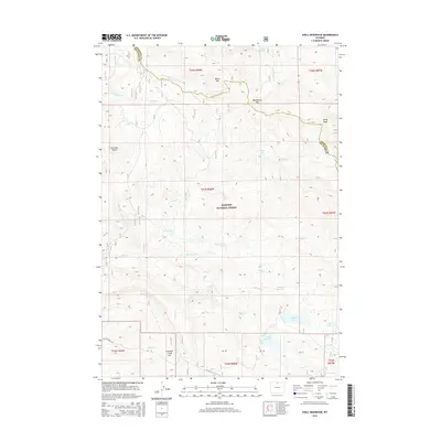
2015 Map of Shell Reservoir
USGS Topo · Published 2015About this map
The Bighorn National Forest defines the high-country landscape of this 2015 survey, straddling the boundary between Sheridan and Big Horn counties. High-altitude hydrology is a primary focus, featuring several engineered and natural water bodies such as Adelaide Reservoir, Shell Reservoir, and the smaller Adelaide Lake. The terrain is punctuated by significant peaks and passes, including Bruce Mtn, Dome Peak, and Woodchuck Pass, which provide a sense of the drainage patterns for the headwaters of Shell Cr and the W Fork S Tongue River. A network of Forest Service routes, such as Battle Creek Rd and Svc Rd 17, provides the only access through this mountain environment. This map serves as an essential record of the protected wilderness and water management infrastructure within the Big Horn Mountains.
Find a feature on this map
41 named features on this map. Tap any name to fly to it.
Don’t see what you’re looking for? This feature index may not catch every label — zoom into the map to look around manually.
Map Details
Editions of this 2015 Shell Reservoir Map
This is the sole edition of this map. No revisions or reprints were ever made.
Other maps of this area

1895 · Dayton
USGS Topo · 1:125,000

1898 · Bald Mountain
USGS Topo · 1:125,000

1899 · Cloud peak
USGS Topo · 1:125,000

1901 · Cloud Peak
USGS Topo · 1:125,000

1901 · Dayton
USGS Topo · 1:125,000

1901 · Bald Mountain
USGS Topo · 1:125,000

1955 · Sheridan
USGS Topo · 1:250,000

1958 · Sheridan
USGS Topo · 1:250,000

1960 · Shell Falls
USGS Topo · 1:24,000

1960 · Shell Lake
USGS Topo · 1:24,000