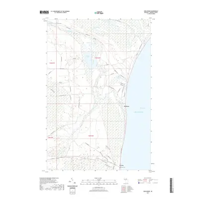
2019 Map of Shelldrake
USGS Topo · Published 2019About this map
Shelldrake sits along the shoreline of Whitefish Bay, where the Shelldrake River meets the cold waters of Lake Superior. This northern Michigan landscape is defined by its extensive wetlands and river systems, including the S Br Shelldrake River and unique water bodies like The Widewaters and Hawkins Lake. To the south, the community of Paradise serves as a local hub, featuring the Paradise Cem and connections to the Paradise Pathway. The map reveals a network of roads such as N Whitefish Point Rd and W M 123 that navigate the low-lying terrain between Shelldrake Lake and the coast. This 2019 survey documents a region where the natural hydrology of the McMullan Lakes and Dead Cr continues to dictate the patterns of human settlement and transport in Whitefish Township.
Find a feature on this map
45 named features on this map. Tap any name to fly to it.
Don’t see what you’re looking for? This feature index may not catch every label — zoom into the map to look around manually.
Map Details
Editions of this 2019 Shelldrake Map
This is the sole edition of this map. No revisions or reprints were ever made.
Other maps of this area

1951 · Vermilion SE
USGS Topo · 1:24,000

1951 · Shelldrake
USGS Topo · 1:24,000

1951 · Vermilion
USGS Topo · 1:24,000

1951 · Sheephead Lake
USGS Topo · 1:24,000

1951 · Emerson
USGS Topo · 1:24,000

1951 · Whitefish Point
USGS Topo · 1:24,000

1951 · Timberlost
USGS Topo · 1:24,000

1951 · Shelldrake
USGS Topo · 1:62,500

1954 · Sault Sainte Marie
USGS Topo · 1:250,000

1956 · Sault Sainte Marie
USGS Topo · 1:250,000