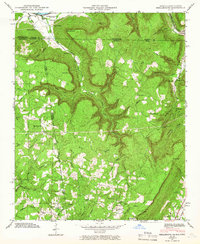
1945 Map of Shellmound
USGS Topo · Published 1966About this map
Guntersville Res and the N C & St L railroad corridor define the northern border of this tri-state region where Tennessee, Alabama, and Georgia converge. The landscape is dominated by the deep incisions of Castle Rock Gulf and Tatum Gulf, which carve through the high plateaus near Burnett Point and Castle Rock. Settlement is concentrated in the valley floors and along the rail lines, featuring small communities like Whiteside and Cole City. The map reveals a dense network of rural social institutions, including the Secalt Sch and Davis Sch, alongside numerous country churches such as Shanty Town Ch and Ebenezer Ch. Significant landmarks like Nickajack Cave near the State Line Cem highlight the unique geographical and historical intersections of these three states.
Find a feature on this map
68 named features on this map. Tap any name to fly to it.
Don’t see what you’re looking for? This feature index may not catch every label — zoom into the map to look around manually.
Map Details
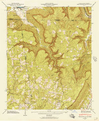
Editions of this 1945 Shellmound Map
2 editions found
Other maps of this area

1886 · Ringgold
USGS Topo · 1:125,000

1886 · Stevenson
USGS Topo · 1:125,000

1888 · Chattanooga
USGS Topo · 1:125,000

1892 · Ringgold
USGS Topo · 1:125,000

1892 · Stevenson
USGS Topo · 1:125,000

1893 · Chattanooga
USGS Topo · 1:125,000

1895 · Stevenson
USGS Topo · 1:125,000

1895 · Sewanee
USGS Topo · 1:125,000

1935 · Durham
USGS Topo · 1:24,000

1936 · Trenton
USGS Topo · 1:24,000