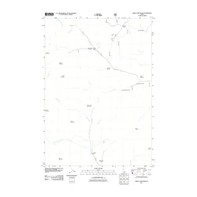
2011 Map of Shelly Mountain
USGS Topo · Published 2011About this map
Shelly Mountain rises as a central landmark in this high-elevation corner of Custer County, where the southern reaches of the White Knob Mountains meet a network of steep canyons and alpine drainages. The landscape is defined by its industrial and natural geography, notably the Champion Mine located near Chimney Gulch and Cliff Creek. This area serves as a significant drainage basin, with Alder Creek and Lupine Creek carving paths through the terrain toward Mud Lake.
Find a feature on this map
35 named features on this map. Tap any name to fly to it.
Don’t see what you’re looking for? This feature index may not catch every label — zoom into the map to look around manually.
Map Details
Editions of this 2011 Shelly Mountain Map
This is the sole edition of this map. No revisions or reprints were ever made.
Other maps of this area

1935 · MacKay
USGS Topo · 1:96,000

1940 · Mackay
USGS Topo · 1:62,500

1955 · Idaho Falls
USGS Topo · 1:250,000

1958 · Idaho Falls
USGS Topo · 1:250,000

1960 · Muldoon Canyon
USGS Topo · 1:62,500

1960 · Grouse
USGS Topo · 1:62,500

1960 · Mackay
USGS Topo · 1:62,500

1960 · Copper Basin
USGS Topo · 1:62,500
1988 · Arco
USGS Topo · 1:100,000
1991 · Mackay
USGS Topo · 1:24,000