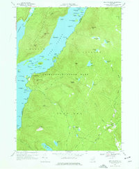
1966 Map of Shelving Rock
USGS Topo · Published 1977About this map
Adirondack State Park forms the wild backdrop of this mid-1960s survey, capturing the complex shoreline and interior highlands between Bolton and Fort Ann. The landscape is dominated by the Tongue Mountain Range and prominent peaks like Black Mountain and Sleeping Beauty. In the water, Lake George is dotted with numerous named islands, including the Mother Bunch Islands, Floating Battery Island, and the Three Sirens Island, while the constricted passage of The Narrows emphasizes the area's geological character.
Find a feature on this map
84 named features on this map. Tap any name to fly to it.
Don’t see what you’re looking for? This feature index may not catch every label — zoom into the map to look around manually.
Map Details
Editions of this 1966 Shelving Rock Map
3 editions found
Other maps of this area

1893 · Fort Ann
USGS Topo · 1:62,500

1893 · Whitehall
USGS Topo · 1:62,500

1895 · Whitehall
USGS Topo · 1:62,500

1895 · Fort Ann
USGS Topo · 1:62,500

1895 · Glens Falls
USGS Topo · 1:62,500

1897 · Bolton
USGS Topo · 1:62,500

1897 · Glens Falls
USGS Topo · 1:62,500

1898 · Whitehall
USGS Topo · 1:62,500

1898 · Fort Ann
USGS Topo · 1:62,500

1900 · Bolton
USGS Topo · 1:62,500