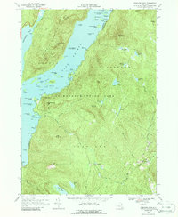
1966 Map of Shelving Rock
USGS Topo · Published 1988About this map
Lake George dominates the western half of this mid-1960s survey, its waters punctuated by numerous islands such as the Mother Bunch Islands and Three Sirens Island. The landscape is defined by the sharp elevations of the Tongue Mountain Range, including French Point Mtn and Fifth Peak, which overlook the Northwest Bay. This wilderness character is preserved within the Adirondack State Park, where isolated water bodies like Fishbrook Pond and Lapland Pond sit high above the lake level.
Find a feature on this map
83 named features on this map. Tap any name to fly to it.
Don’t see what you’re looking for? This feature index may not catch every label — zoom into the map to look around manually.
Map Details
Editions of this 1966 Shelving Rock Map
3 editions found
Other maps of this area

1893 · Fort Ann
USGS Topo · 1:62,500

1893 · Whitehall
USGS Topo · 1:62,500

1895 · Whitehall
USGS Topo · 1:62,500

1895 · Fort Ann
USGS Topo · 1:62,500

1895 · Glens Falls
USGS Topo · 1:62,500

1897 · Bolton
USGS Topo · 1:62,500

1897 · Glens Falls
USGS Topo · 1:62,500

1898 · Whitehall
USGS Topo · 1:62,500

1898 · Fort Ann
USGS Topo · 1:62,500

1900 · Bolton
USGS Topo · 1:62,500