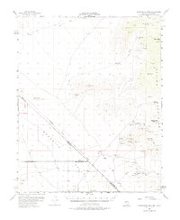
1956 Map of Shenandoah Peak
USGS Topo · Published 1975About this map
Potosi Mine and numerous other mineral claims anchor the rugged eastern slopes of the Spring Mountains in this mid-century survey of the Nevada-California borderlands. The landscape is defined by its hard-rock mining legacy, featuring an extensive network of workings including the Green Monster Mine, Keystone Mine, and the Shenandoah Mine. Below these peaks, the Shenandoah Mill and a nearby Cem mark the industrial and human footprint of these remote operations near the edge of the Mesquite Valley.
Find a feature on this map
51 named features on this map. Tap any name to fly to it.
Don’t see what you’re looking for? This feature index may not catch every label — zoom into the map to look around manually.
Map Details
Editions of this 1956 Shenandoah Peak Map
3 editions found

Other maps of this area

1907 · Las Vegas
USGS Topo · 1:250,000

1908 · Las Vegas
USGS Topo · 1:250,000

1910 · Ivanpah
USGS Topo · 1:250,000

1912 · Ivanpah
USGS Topo · 1:250,000

1942 · Ivanpah
USGS Topo · 1:250,000

1947 · Kingman
USGS Topo · 1:250,000

1948 · Kingman
USGS Topo · 1:250,000

1952 · Blue Diamond
USGS Topo · 1:62,500

1954 · Las Vegas
USGS Topo · 1:250,000

1954 · Kingman
USGS Topo · 1:250,000