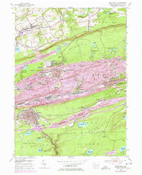
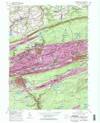
1955 Map of Shenandoah
USGS Topo · Published 1978About this map
Shenandoah and the surrounding anthracite coal country are shown here in detail during the mid-20th century. The landscape is defined by the steep ridges of Locust Mountain and Bear Ridge, where the complex network of the Conrail lines snakes through narrow valleys to serve coal-patch towns like Ellen Gowan, Maizeville, and Pattersonville. Industrial footprints are prominent, particularly the East William Penn (Shaft P O) and numerous water management systems such as the Kehly Run Reservoirs and Waste House Run Reservoirs that supplied the dense mining communities.
Find a feature on this map
85 named features on this map. Tap any name to fly to it.
Don’t see what you’re looking for? This feature index may not catch every label — zoom into the map to look around manually.
Map Details
Editions of this 1955 Shenandoah Map
5 editions found
Other maps of this area

1889 · Catawissa
USGS Topo · 1:62,500

1889 · Pottsville
USGS Topo · 1:62,500

1891 · Pottsville
USGS Topo · 1:62,500

1892 · Catawissa
USGS Topo · 1:62,500

1892 · Mahanoy
USGS Topo · 1:62,500

1892 · Pine Grove
USGS Topo · 1:62,500

1893 · Mahanoy
USGS Topo · 1:62,500

1894 · Catawissa
USGS Topo · 1:62,500

1944 · Pottsville
USGS Topo · 1:24,000

1944 · Orwigsburg
USGS Topo · 1:24,000