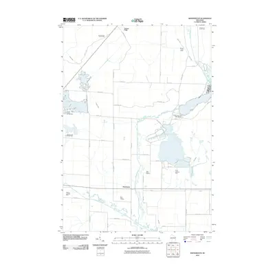
2010 Map of Shennington
USGS Topo · Published 2010About this map
Shennington and Norway Ridge anchor this landscape in Juneau County, where the transition from marshy wetlands to upland woods is marked by a network of drainage ditches and small dams. The southern reach is defined by the winding course of the Lemonweir River, while the northern terrain rises toward the Norway Ridge Lookout Tower. This 2010 survey shows a rural economy supported by small-scale aviation and water management, evidenced by the Potter Landing Strip and several controlled water bodies such as Potters Reservoir 2WP 188 Dam. For those tracing local heritage, the map identifies the locations of Saint Peters Cemetery and Saint Johns Cemetery, alongside an intricate grid of backcountry roads like Blueberry Trl and Frontier Ave.
Find a feature on this map
46 named features on this map. Tap any name to fly to it.
Don’t see what you’re looking for? This feature index may not catch every label — zoom into the map to look around manually.
Map Details
Editions of this 2010 Shennington Map
This is the sole edition of this map. No revisions or reprints were ever made.
Other maps of this area

1919 · Kendall
USGS Topo · 1:62,500

1921 · Mauston
USGS Topo · 1:62,500

1921 · Kendall
USGS Topo · 1:62,500

1953 · Eau Claire
USGS Topo · 1:250,000

1958 · Eau Claire
USGS Topo · 1:250,000

1958 · Necedah
USGS Topo · 1:48,000

1958 · Wyeville
USGS Topo · 1:48,000

1958 · La Crosse
USGS Topo · 1:250,000

1961 · La Crosse
USGS Topo · 1:250,000

1962 · Kendall
USGS Topo · 1:62,500