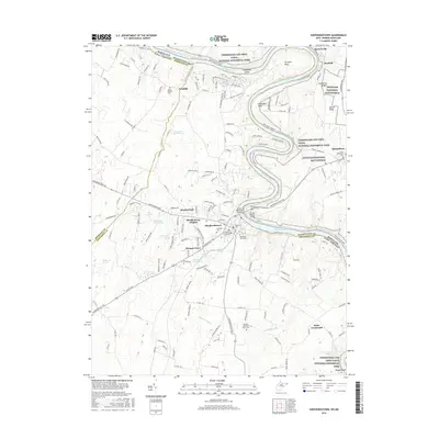
2016 Map of Shepherdstown
USGS Topo · Published 2016About this map
The Potomac River meanders sharply through the Shenandoah Valley, serving as the border between Shepherdstown, West Virginia, and Sharpsburg, Maryland. This landscape is defined by its deep historical layers, from the protected grounds of Antietam National Battlefield to the long industrial corridor of the Chesapeake and Ohio Canal. The map reveals a dense network of family and community history, evidenced by numerous burial grounds like the Shepherds Graveyard, Elmwood Cem, and the Buckles Reverend Black Cem. The terrain is marked by significant water features and agricultural sites, including Morgan Spring and Rockmarsh Run. Modern academic life at Shepherd Univ sits adjacent to these historical landmarks, while the C&O Canal Towpath follows the river’s edge past Horseshoe Bend and Terrapin Neck, tracing the path of 19th-century commerce.
Find a feature on this map
167 named features on this map. Tap any name to fly to it.
Don’t see what you’re looking for? This feature index may not catch every label — zoom into the map to look around manually.
Map Details
Editions of this 2016 Shepherdstown Map
This is the sole edition of this map. No revisions or reprints were ever made.
Other maps of this area

1884 · Harpers Ferry
USGS Topo · 1:125,000

1891 · Harpers Ferry
USGS Topo · 1:125,000

1893 · Harpers Ferry
USGS Topo · 1:125,000

1908 · Middletown
USGS Topo · 1:48,000

1909 · Hagerstown
USGS Topo · 1:48,000

1910 · Antietam
USGS Topo · 1:62,500

1912 · Hagerstown
USGS Topo · 1:62,500

1912 · Williamsport
USGS Topo · 1:62,500

1914 · Martinsburg
USGS Topo · 1:48,000

1916 · Martinsburg
USGS Topo · 1:62,500