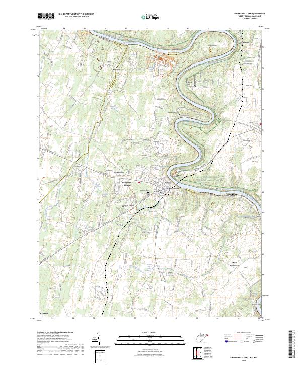
2023 Map of Shepherdstown
USGS Topo · Published 2023About this map
The Potomac River winds through a landscape defined by historic water crossings and established agrarian settlements in this 2023 survey of the West Virginia-Maryland border. The town of Shepherdstown serves as a central hub, preserving several legacy burial grounds such as Shepherds Graveyard and Reformed Graveyard. Along the riverbanks, the engineering of the Chesapeake and Ohio Canal remains a prominent feature, following the bends near Horseshoe Bend and Terrapin Neck, where the Potomac Heritage National Scenic Trl now traces the old towpath.
Find a feature on this map
80 named features on this map. Tap any name to fly to it.
Don’t see what you’re looking for? This feature index may not catch every label — zoom into the map to look around manually.
Map Details
Editions of this 2023 Shepherdstown Map
This is the sole edition of this map. No revisions or reprints were ever made.
Historical Maps of Taylors Landing Through Time
5 maps found