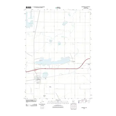
2010 Map of Sherburn
USGS Topo · Published 2010About this map
Sherburn serves as the primary hub in this southern Minnesota landscape, concentrated near the southern shores of Temperance Lake. The settlement patterns here are deeply tied to the local hydrology, with the town's infrastructure supported by the Sherburn Post Office and several local burial grounds, including Saint Lukes Cemetery and Sherburne City Cemetery. The surrounding countryside is defined by a network of drainage systems such as Judicial Ditch Number Fifty and Judicial Ditch Number Thirtyseven, which reflect the region's agricultural adaptation to its naturally lake-rich terrain.
Find a feature on this map
54 named features on this map. Tap any name to fly to it.
Don’t see what you’re looking for? This feature index may not catch every label — zoom into the map to look around manually.
Map Details
Editions of this 2010 Sherburn Map
This is the sole edition of this map. No revisions or reprints were ever made.
Other maps of this area

1954 · Fairmont
USGS Topo · 1:250,000

1958 · Fairmont
USGS Topo · 1:250,000

1970 · St James SE
USGS Topo · 1:24,000

1970 · Ceylon
USGS Topo · 1:24,000

1970 · Trimont
USGS Topo · 1:24,000

1970 · Mountain Lake SE
USGS Topo · 1:24,000

1970 · Welcome
USGS Topo · 1:24,000

1970 · Dunnell
USGS Topo · 1:24,000

1970 · Wilbert
USGS Topo · 1:24,000

1970 · Sherburn
USGS Topo · 1:24,000