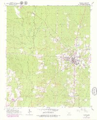
1964 Map of Sheridan
USGS Topo · Published 1979About this map
The Grant County seat of Sheridan serves as the central hub of this mid-1960s survey, updated with late-1970s land use changes. The town's grid is defined by the Missouri Pacific railroad corridor and a network of local waterways, including Lost Creek and the West Fork. The landscape is a mix of municipal development and rural infrastructure, featuring the Lost Creek Cem, a Golf Course, and a Fish Hatchery near the southern boundary. Significant timber and resource extraction activity is evident from the numerous Gravel Pits scattered across the Davis and Calvert townships.
Find a feature on this map
27 named features on this map. Tap any name to fly to it.
Don’t see what you’re looking for? This feature index may not catch every label — zoom into the map to look around manually.
Map Details
Editions of this 1964 Sheridan Map
3 editions found
Other maps of this area

1955 · Little Rock
USGS Topo · 1:250,000

1956 · Little Rock
USGS Topo · 1:250,000

1960 · Little Rock
USGS Topo · 1:250,000

1963 · Prattsville
USGS Topo · 1:24,000
1963 · Tull
USGS Topo · 1:24,000

1964 · Little Rock
USGS Topo · 1:250,000

1964 · Sheridan
USGS Topo · 1:24,000

1964 · Cane Creek
USGS Topo · 1:24,000

1964 · Belfast
USGS Topo · 1:24,000
1964 · Millerville
USGS Topo · 1:24,000