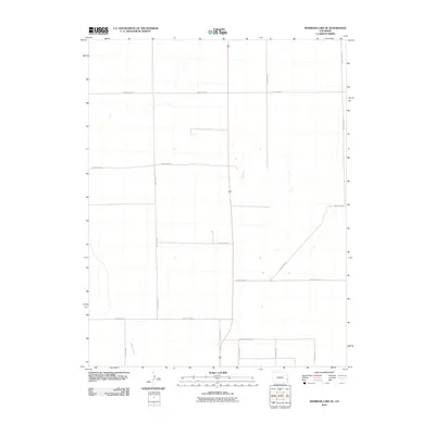
2010 Map of Sheridan Lake SE
USGS Topo · Published 2010About this map
Buffalo Creek winds through the southwestern corner of this high plains landscape in Prowers County, providing a rare natural curve against an otherwise rigid section-line grid. This area of eastern Colorado is defined by its sprawling agricultural layout, where life and commerce are organized by an extensive network of rural routes. Prominent thoroughfares like County Road A and County Road G anchor the local transport system, connecting the region's isolated farmsteads and fields. Surveyed by the U.S. Geological Survey in the early 21st century, the map reveals the persistent geometry of the American West, where north-south arteries such as County Rd 64 and County Rd 24.5 intersect the horizon at precise intervals, facilitating the movement of goods in this open, productive country.
Find a feature on this map
15 named features on this map. Tap any name to fly to it.
Don’t see what you’re looking for? This feature index may not catch every label — zoom into the map to look around manually.
Map Details
Editions of this 2010 Sheridan Lake SE Map
This is the sole edition of this map. No revisions or reprints were ever made.
Other maps of this area

1890 · Granada
USGS Topo · 1:125,000

1892 · Granada
USGS Topo · 1:125,000

1894 · Granada
USGS Topo · 1:125,000

1954 · Lamar
USGS Topo · 1:250,000

1955 · Granada NW
USGS Topo · 1:24,000

1955 · Granada NE
USGS Topo · 1:24,000
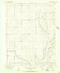
1955 · Holly NW
USGS Topo · 1:24,000

1958 · Lamar
USGS Topo · 1:250,000

1968 · Stuart
USGS Topo · 1:24,000

1968 · Sheridan Lake
USGS Topo · 1:24,000