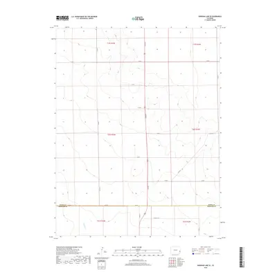
2019 Map of Sheridan Lake SE
USGS Topo · Published 2019About this map
Buffalo Cr winds through the southern reaches of this High Plains landscape, marking one of the few distinct hydrologic features in an area defined by its rigorous section-line geometry. Situated along the border of Kiowa Co Prowers Co, the terrain is organized by a network of rural routes including Co Rd G and Co Rd WW, which facilitate movement across the large township and range blocks of T19S and T20S. This 2019 survey illustrates the enduring patterns of agricultural land division in Eastern Colorado, where the transition between Kiowa and Prowers counties is defined more by administrative lines than by dramatic topographic shifts. The cartography highlights the sparse but essential infrastructure of the region, emphasizing the importance of local roads like Co Rd 66 and Co Rd 64 in connecting the expansive open country.
Find a feature on this map
23 named features on this map. Tap any name to fly to it.
Don’t see what you’re looking for? This feature index may not catch every label — zoom into the map to look around manually.
Map Details
Editions of this 2019 Sheridan Lake SE Map
This is the sole edition of this map. No revisions or reprints were ever made.
Other maps of this area

1890 · Granada
USGS Topo · 1:125,000

1892 · Granada
USGS Topo · 1:125,000

1894 · Granada
USGS Topo · 1:125,000

1954 · Lamar
USGS Topo · 1:250,000

1955 · Granada NW
USGS Topo · 1:24,000

1955 · Granada NE
USGS Topo · 1:24,000
1955 · Holly NW
USGS Topo · 1:24,000

1958 · Lamar
USGS Topo · 1:250,000

1968 · Stuart
USGS Topo · 1:24,000

1968 · Sheridan Lake
USGS Topo · 1:24,000