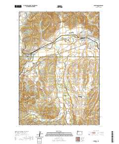
2020 Map of Sheridan
USGS Topo · Published 2020About this map
The South Yamhill River cuts through the heart of the landscape, defining the industrial and agricultural character of this region on the border of Yamhill and Polk Counties. Sheridan stands as a central hub, its street grid reaching north toward the Masonic Cem and Abba's Airport, while the Pacific Plywood Log Pond near Willamina reflects the local importance of the timber industry. The area is dotted with small rural centers such as Red Prairie and Buell, connected by a network of drainage-following roads like Mill Creek Rd and Red Prairie Rd.
Find a feature on this map
106 named features on this map. Tap any name to fly to it.
Don’t see what you’re looking for? This feature index may not catch every label — zoom into the map to look around manually.
Map Details
Editions of this 2020 Sheridan Map
This is the sole edition of this map. No revisions or reprints were ever made.
Other maps of this area

1942 · Sheridan
USGS Topo · 1:62,500

1942 · Spirit Mtn
USGS Topo · 1:62,500

1942 · Valsetz
USGS Topo · 1:62,500

1942 · Dallas
USGS Topo · 1:62,500

1948 · Vancouver
USGS Topo · 1:250,000

1950 · Vancouver
USGS Topo · 1:250,000

1950 · Vancouver
USGS Topo · 1:250,000

1953 · Salem
USGS Topo · 1:250,000

1954 · Salem
USGS Topo · 1:250,000

1955 · Grand Ronde
USGS Topo · 1:62,500