
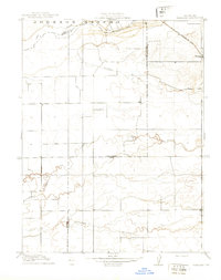
1910 Map of Sheridan
USGS Topo · Published 1910About this map
Johnson Rancho dominates the northern landscape of this 1908 survey, where the historic land grant is bisected by the Bear River at the junction of Sutter and Yuba counties. The settlement of Sheridan serves as a vital rail point along the S. P. R. R. (Marysville Line), which cuts through the northeastern corner of the map. This area is characterized by a complex network of waterways, including Yankee Slough and Coon Creek, which drain the low-lying agricultural plains. The presence of the Fairview School at a central crossroads highlights the rural community structure of early 20th-century Placer County. To the south, the terrain becomes increasingly defined by drainage features like Markham Ravine and Bunkham Ravine, illustrating the natural irrigation and runoff patterns that shaped early California ranching and settlement long before modern development.
Find a feature on this map
12 named features on this map. Tap any name to fly to it.
Don’t see what you’re looking for? This feature index may not catch every label — zoom into the map to look around manually.
Map Details
Editions of this 1910 Sheridan Map
2 editions found
Other maps of this area

1888 · Marysville
USGS Topo · 1:125,000

1888 · Smartsville
USGS Topo · 1:125,000

1891 · Sacramento
USGS Topo · 1:125,000

1891 · Marysville
USGS Topo · 1:125,000

1891 · Smartsville
USGS Topo · 1:125,000

1892 · Sacramento
USGS Topo · 1:125,000

1892 · Smartsville
USGS Topo · 1:125,000

1893 · Sacramento
USGS Topo · 1:125,000

1894 · Smartsville
USGS Topo · 1:125,000

1894 · Marysville
USGS Topo · 1:125,000