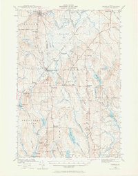
1940 Map of Sherman
USGS Topo · Published 1965About this map
The Bangor and Aroostook railroad cuts through the heart of this Aroostook County landscape, anchoring the connected settlements of Sherman Station and Sherman Mills. In 1940, this region was a network of small village hubs and rural school districts, including the Longfellow Sch and Doble Sch. The area is defined by its complex hydrology, dominated by the massive Thousand Acre Bog and the southward flow of Fish Stream and Macwahoc Stream.
Find a feature on this map
75 named features on this map. Tap any name to fly to it.
Don’t see what you’re looking for? This feature index may not catch every label — zoom into the map to look around manually.
Map Details
Editions of this 1940 Sherman Map
2 editions found
Other maps of this area

1937 · Smyrna Mills
USGS Topo · 1:62,500

1940 · Island Falls
USGS Topo · 1:62,500

1940 · Sherman
USGS Topo · 1:62,500

1940 · Mattawamkeag
USGS Topo · 1:62,500

1941 · Mattawamkeag Lake
USGS Topo · 1:62,500

1941 · Wytopitlock
USGS Topo · 1:62,500

1942 · Island Falls
USGS Topo · 1:62,500

1942 · Mattawamkeag
USGS Topo · 1:62,500

1942 · Sherman
USGS Topo · 1:62,500

1943 · Wytopitlock
USGS Topo · 1:62,500