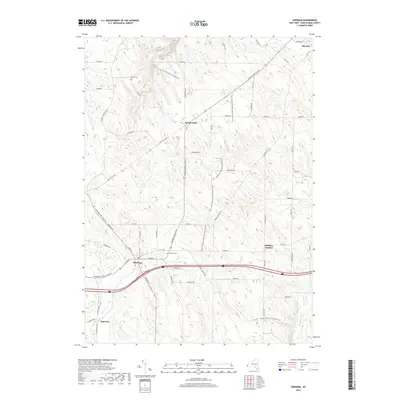
2019 Map of Sherman
USGS Topo · Published 2019About this map
Sherman serves as the primary hub in this corner of Chautauqua County, situated where French Cr winds through the village center. The map documents a landscape defined by the transition from agricultural valley bottoms to the more elevated ridges of the Southern Tier. Long-distance hiking is represented by the extensive Fred J. Cusimano Westside Overland Trail, which traverses the hills between Summerdale and Mayville. Cultural markers like Porter Cem and Sherman Cem provide essential anchor points for genealogical research, while small crossroads like Stebbins Corners and Slab City reflect the persistent local geography of western New York. The drainage network is particularly prominent, showing how Chautauqua Creek and Prendergast Cr carve into the upland plateaus.
Find a feature on this map
64 named features on this map. Tap any name to fly to it.
Don’t see what you’re looking for? This feature index may not catch every label — zoom into the map to look around manually.
Map Details
Editions of this 2019 Sherman Map
This is the sole edition of this map. No revisions or reprints were ever made.
Other maps of this area

1899 · Westfield
USGS Topo · 1:62,500

1900 · Dunkirk
USGS Topo · 1:62,500

1904 · Chautaqua
USGS Topo · 1:62,500

1905 · Clymer
USGS Topo · 1:62,500

1939 · Clymer
USGS Topo · 1:62,500

1941 · Chautauqua
USGS Topo · 1:62,500

1941 · Clymer
USGS Topo · 1:62,500

1943 · Dunkirk
USGS Topo · 1:62,500

1954 · Chautauqua
USGS Topo · 1:24,000

1954 · South Ripley
USGS Topo · 1:24,000