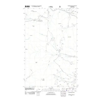
2011 Map of Sherman Peak
USGS Topo · Published 2011About this map
Sherman Peak and the surrounding high country of the Kettle River Range are defined here by a network of drainage systems and high-altitude lookouts. Elevated vantage points at the Columbia Mountain Lookout and White Mountain Lookout offer a perspective on the complex topography where Sherman Creek and Barnaby Creek originate. The presence of Sherman Pass and its associated Sherman Pass Campground indicates the importance of this high-altitude crossing for transit through the mountain interior. The map documents the intricate creek systems including the South Fork Sherman Creek and the South Fork Barnaby Creek, which carve deep valleys through the terrain. Evidence of seasonal use and forest management is seen in the placement of Snowshoe Camp and various forest roads such as the S Fork Sherman Creek Rd and Cedar Rd. Landforms like Scalawag Ridge and Barnaby Buttes provide significant landmarks for navigation and land use study in this part of Ferry County.
Find a feature on this map
28 named features on this map. Tap any name to fly to it.
Don’t see what you’re looking for? This feature index may not catch every label — zoom into the map to look around manually.
Map Details
Editions of this 2011 Sherman Peak Map
This is the sole edition of this map. No revisions or reprints were ever made.
Other maps of this area

1904 · Republic
USGS Topo · 1:125,000

1936 · Marcus
USGS Topo · 1:96,000

1942 · Marcus
USGS Topo · 1:125,000

1948 · Republic
USGS Topo · 1:62,500

1948 · Sherman Peak
USGS Topo · 1:62,500

1951 · Sherman Peak
USGS Topo · 1:62,500

1951 · Republic
USGS Topo · 1:62,500

1952 · Twin Lakes
USGS Topo · 1:62,500

1953 · Seventeenmile Mtn.
USGS Topo · 1:62,500

1954 · Okanogan
USGS Topo · 1:250,000