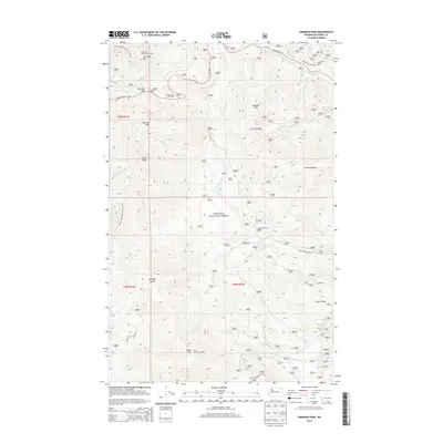
2014 Map of Sherman Peak
USGS Topo · Published 2014About this map
Columbia Mountain Lookout and White Mountain Lookout anchor the high elevations of this section of the Colville National Forest in Ferry County. The landscape is defined by the Kettle River Range, where Sherman Peak and Snow Peak rise above the drainage systems of Sherman Cr and Barnaby Cr. This 2014 survey captures the modern infrastructure of the mountain pass, including the Sherman Pass Campground and the higher-altitude Snowshoe Camp located near the headwaters of Snowshoe Cr. The Pacific NW National Scenic Trail winds through the western ridges, intersecting with State Hwy 20 at Sherman Pass. The presence of these lookout points and the extensive forest road network, such as Nat For Dev Rd 155 and Graves Mountain RD, illustrates the ongoing management of this high-country wilderness.
Find a feature on this map
32 named features on this map. Tap any name to fly to it.
Don’t see what you’re looking for? This feature index may not catch every label — zoom into the map to look around manually.
Map Details
Editions of this 2014 Sherman Peak Map
This is the sole edition of this map. No revisions or reprints were ever made.
Other maps of this area

1904 · Republic
USGS Topo · 1:125,000

1936 · Marcus
USGS Topo · 1:96,000

1942 · Marcus
USGS Topo · 1:125,000

1948 · Republic
USGS Topo · 1:62,500

1948 · Sherman Peak
USGS Topo · 1:62,500

1951 · Sherman Peak
USGS Topo · 1:62,500

1951 · Republic
USGS Topo · 1:62,500

1952 · Twin Lakes
USGS Topo · 1:62,500

1953 · Seventeenmile Mtn.
USGS Topo · 1:62,500

1954 · Okanogan
USGS Topo · 1:250,000