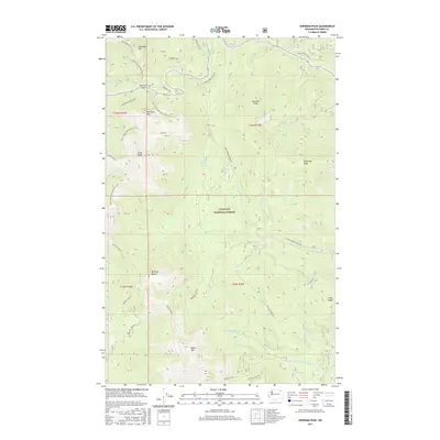
2017 Map of Sherman Peak
USGS Topo · Published 2017About this map
Sherman Pass serves as a critical high-elevation crossing through the Kettle River Range within the Colville National Forest. This 2017 survey documents a landscape defined by significant peaks and ridges, including Columbia Mtn, Sherman Peak, and Snow Peak. The region is a focal point for modern recreation, highlighted by the passage of the Pacific NW National Scenic Trail, which traverses the high ground near Paradise Peak and south toward White Mtn. The drainage network is clearly articulated, with headwaters for Sherman Creek, Barnaby Creek, and Bridge Creek carving deep valleys between the massifs. Forest Service infrastructure is visible through named routes like the Sherman Peak Loop and Barnaby Creek Rd, providing a record of the access points used for timber management and wilderness exploration in northeastern Washington.
Find a feature on this map
37 named features on this map. Tap any name to fly to it.
Don’t see what you’re looking for? This feature index may not catch every label — zoom into the map to look around manually.
Map Details
Editions of this 2017 Sherman Peak Map
This is the sole edition of this map. No revisions or reprints were ever made.
Other maps of this area

1904 · Republic
USGS Topo · 1:125,000

1936 · Marcus
USGS Topo · 1:96,000

1942 · Marcus
USGS Topo · 1:125,000

1948 · Republic
USGS Topo · 1:62,500

1948 · Sherman Peak
USGS Topo · 1:62,500

1951 · Sherman Peak
USGS Topo · 1:62,500

1951 · Republic
USGS Topo · 1:62,500

1952 · Twin Lakes
USGS Topo · 1:62,500

1953 · Seventeenmile Mtn.
USGS Topo · 1:62,500

1954 · Okanogan
USGS Topo · 1:250,000