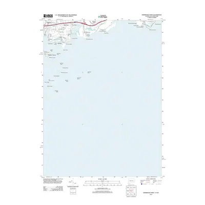
2012 Map of Sherwood Point
USGS Topo · Published 2012About this map
The Saugatuck River flows into the protected waters of Long Island Sound, defining a coastal landscape of peninsulas and offshore hazards. This 2012 survey documents the residential and recreational development around Saugatuck and Greens Farms, where modern road networks like Mayflower Pkwy and Greens Farms Rd weave between the shore and the rail corridor. The nautical character of the area is emphasized by the numerous named reefs and rocks, such as Hanford Rock and Haycock Rock, which surround Cockenoe Island. To the west, Peck Ledge Lighthouse stands as a vital navigational aid marking the entrance to the bay. Public access points and recreation areas are well-established, including Sherwood Island, Alvord Beach, and Burial Hill Beach, illustrating the shoreline's transition into a prime residential and leisure destination.
Find a feature on this map
69 named features on this map. Tap any name to fly to it.
Don’t see what you’re looking for? This feature index may not catch every label — zoom into the map to look around manually.
Map Details
Editions of this 2012 Sherwood Point Map
This is the sole edition of this map. No revisions or reprints were ever made.
Other maps of this area

1891 · Bridgeport
USGS Topo · 1:62,500

1892 · Norwalk
USGS Topo · 1:62,500

1893 · Bridgeport
USGS Topo · 1:62,500

1893 · Norwalk
USGS Topo · 1:62,500

1901 · Northport
USGS Topo · 1:62,500

1902 · Setauket
USGS Topo · 1:62,500

1903 · Northport
USGS Topo · 1:62,500

1904 · Setauket
USGS Topo · 1:62,500

1904 · Islip
USGS Topo · 1:125,000

1919 · Setauket
USGS Topo · 1:62,500