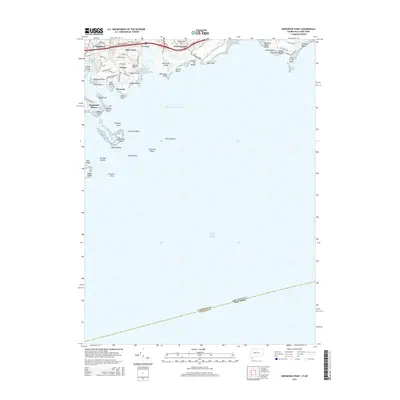
2015 Map of Sherwood Point
USGS Topo · Published 2015About this map
The coastal interface of Long Island Sound defines this 2015 survey, documenting the intricate shoreline between Saugatuck and Fairfield Beach. The map illustrates a highly developed residential and recreational landscape, where historic neighborhoods like Greens Farms and Compo meet the water at Sherwood Island and Alvord Beach. Inland, local landmarks such as Saint Marys Cem and Clapboard Hill sit among a dense network of suburban roads including Beachside Ave and Greens Farms Rd.
Find a feature on this map
65 named features on this map. Tap any name to fly to it.
Don’t see what you’re looking for? This feature index may not catch every label — zoom into the map to look around manually.
Map Details
Editions of this 2015 Sherwood Point Map
This is the sole edition of this map. No revisions or reprints were ever made.
Other maps of this area

1891 · Bridgeport
USGS Topo · 1:62,500

1892 · Norwalk
USGS Topo · 1:62,500

1893 · Bridgeport
USGS Topo · 1:62,500

1893 · Norwalk
USGS Topo · 1:62,500

1901 · Northport
USGS Topo · 1:62,500

1902 · Setauket
USGS Topo · 1:62,500

1903 · Northport
USGS Topo · 1:62,500

1904 · Setauket
USGS Topo · 1:62,500

1904 · Islip
USGS Topo · 1:125,000

1919 · Setauket
USGS Topo · 1:62,500