
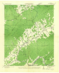
1935 Map of Sherwood
USGS Topo · Published 1935About this map
Stone Mountain and the state border between Tennessee and North Carolina anchor this 1935 study, where the Watauga River winds through the southern terrain past Watauga Falls. The landscape is defined by tight mountain ridges like Fork Ridge and Lost Ridge, which channel settlement into the narrow hollows and creek valleys. Clusters of rural life appear at Sherwood, Sugar Grove, and Mabel, connected by the route of State Highway No 421.
Find a feature on this map
93 named features on this map. Tap any name to fly to it.
Don’t see what you’re looking for? This feature index may not catch every label — zoom into the map to look around manually.
Map Details
Editions of this 1935 Sherwood Map
This is the sole edition of this map. No revisions or reprints were ever made.
Other maps of this area

1893 · Cranberry
USGS Topo · 1:125,000

1895 · Cranberry
USGS Topo · 1:125,000

1899 · Cranberry
USGS Topo · 1:125,000

1902 · Cranberry
USGS Topo · 1:125,000

1934 · Valle Crucis
USGS Topo · 1:24,000

1934 · Elk Park
USGS Topo · 1:24,000

1934 · Boone
USGS Topo · 1:24,000
1935 · Doe
USGS Topo · 1:24,000

1935 · Baldwin Gap
USGS Topo · 1:24,000

1935 · Doe Mountain
USGS Topo · 1:48,000