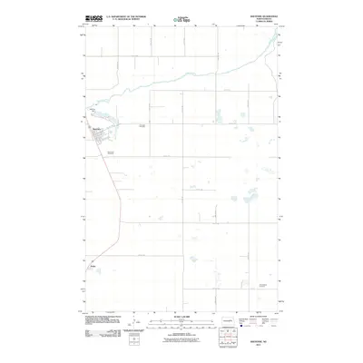
2011 Map of Sheyenne
USGS Topo · Published 2011About this map
The Sheyenne River winds through this central North Dakota landscape, anchoring the town of Sheyenne and the surrounding prairie. Just north of the town site, the Warsing Dam regulates the water's flow, creating a distinct local landmark in a region defined by its grid-based agricultural layout. The settlement itself is articulated through a network of local roads including Sheyenne Ave, Richter Ave, and Sunnyside Ave, which branch off from County Hwy 1. To the south, the small community of Divide sits near several scattered wetlands. The area's heritage is preserved in several burial grounds, including the Riverside Cemetery, Holy Cross Cemetery, and the more remote Morningside Cemetery to the southeast, each serving as a vital point for genealogical research in Eddy County.
Find a feature on this map
23 named features on this map. Tap any name to fly to it.
Don’t see what you’re looking for? This feature index may not catch every label — zoom into the map to look around manually.
Map Details
Editions of this 2011 Sheyenne Map
This is the sole edition of this map. No revisions or reprints were ever made.
Other maps of this area

1928 · Tokio
USGS Topo · 1:62,500

1931 · Oberon
USGS Topo · 1:62,500

1931 · Tokio
USGS Topo · 1:62,500

1944 · Brantford
USGS Topo · 1:62,500

1946 · Brantford
USGS Topo · 1:62,500

1948 · New Rockford
USGS Topo · 1:62,500

1950 · New Rockford
USGS Topo · 1:24,000

1950 · New Rockford NE
USGS Topo · 1:24,000

1950 · Oberon SW
USGS Topo · 1:24,000

1950 · Brantford NW
USGS Topo · 1:24,000