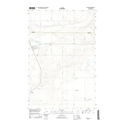
2014 Map of Sheyenne
USGS Topo · Published 2014About this map
The Sheyenne River winds across the northern landscape of this prairie region, which straddles the boundary between Benson Co and Eddy Co. The town of Sheyenne serves as the local hub, situated where Us-281 intersects local routes like Cottonwood Ave and CR-1. Settlement patterns in this part of North Dakota are marked by a series of rural burial grounds, including Holy Cross Cem, Riverside Cem, and Morningside Cem, which offer significant data points for genealogical research. To the south, the small community of Divide and the level terrain of Tiffany Flats define a landscape dominated by a rigorous grid of section-line roads, such as 24th St NE and 71st Ave NE, which facilitated the region's agricultural development.
Find a feature on this map
29 named features on this map. Tap any name to fly to it.
Don’t see what you’re looking for? This feature index may not catch every label — zoom into the map to look around manually.
Map Details
Editions of this 2014 Sheyenne Map
This is the sole edition of this map. No revisions or reprints were ever made.
Other maps of this area

1928 · Tokio
USGS Topo · 1:62,500

1931 · Oberon
USGS Topo · 1:62,500

1931 · Tokio
USGS Topo · 1:62,500

1944 · Brantford
USGS Topo · 1:62,500

1946 · Brantford
USGS Topo · 1:62,500

1948 · New Rockford
USGS Topo · 1:62,500

1950 · New Rockford
USGS Topo · 1:24,000

1950 · New Rockford NE
USGS Topo · 1:24,000

1950 · Oberon SW
USGS Topo · 1:24,000

1950 · Brantford NW
USGS Topo · 1:24,000