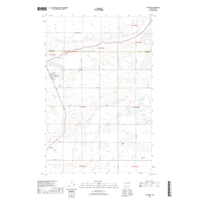
2018 Map of Sheyenne
USGS Topo · Published 2018About this map
Sheyenne sits at the western edge of this North Dakota landscape, where the prairie is shaped by the winding course of the Sheyenne River. This 2018 survey documents the small town's grid, including neighborhood streets like Cottonwood Ave and Richter Ave, alongside essential local institutions such as Holy Cross Cem and Riverside Cem. Further south, the community of Divide appears along the highway corridor, surrounded by the expansive lowlands of Tiffany Flats. The map provides a clear look at the rural intersection of Benson Co and Eddy Co, where a network of section-line roads like 30th St NE and 24th St NE connects isolated farmsteads and cemeteries, including the remote Morningside Cem in the southeastern corner.
Find a feature on this map
27 named features on this map. Tap any name to fly to it.
Don’t see what you’re looking for? This feature index may not catch every label — zoom into the map to look around manually.
Map Details
Editions of this 2018 Sheyenne Map
This is the sole edition of this map. No revisions or reprints were ever made.
Other maps of this area

1928 · Tokio
USGS Topo · 1:62,500

1931 · Oberon
USGS Topo · 1:62,500

1931 · Tokio
USGS Topo · 1:62,500

1944 · Brantford
USGS Topo · 1:62,500

1946 · Brantford
USGS Topo · 1:62,500

1948 · New Rockford
USGS Topo · 1:62,500

1950 · New Rockford
USGS Topo · 1:24,000

1950 · New Rockford NE
USGS Topo · 1:24,000

1950 · Oberon SW
USGS Topo · 1:24,000

1950 · Brantford NW
USGS Topo · 1:24,000