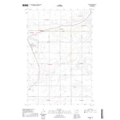
2020 Map of Sheyenne
USGS Topo · Published 2020About this map
The Sheyenne River meanders across the northern portion of this landscape, carving a valley through the high plains of the Benson and Eddy county line. The town of Sheyenne serves as the primary hub, where local streets like Cottonwood Ave and Richter Ave meet the broader transit network. To the south, the rail-oriented settlement of Divide sits near the crossing of Main St S.
Find a feature on this map
28 named features on this map. Tap any name to fly to it.
Don’t see what you’re looking for? This feature index may not catch every label — zoom into the map to look around manually.
Map Details
Editions of this 2020 Sheyenne Map
This is the sole edition of this map. No revisions or reprints were ever made.
Other maps of this area

1928 · Tokio
USGS Topo · 1:62,500

1931 · Oberon
USGS Topo · 1:62,500

1931 · Tokio
USGS Topo · 1:62,500

1944 · Brantford
USGS Topo · 1:62,500

1946 · Brantford
USGS Topo · 1:62,500

1948 · New Rockford
USGS Topo · 1:62,500

1950 · New Rockford
USGS Topo · 1:24,000

1950 · New Rockford NE
USGS Topo · 1:24,000

1950 · Oberon SW
USGS Topo · 1:24,000

1950 · Brantford NW
USGS Topo · 1:24,000