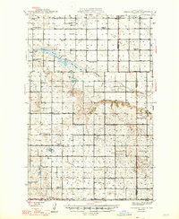
1947 Map of Sheyenne Lake
USGS Topo · Published 1947About this map
Sheridan and Wells counties meet across a landscape defined by the upper reaches of the Sheyenne River during the mid-1940s. The region is characterized by a dense grid of rural school districts, illustrating a high-density pattern of family farming that has since consolidated. Names like New Germantown Sch No 1, Schiller Sch No 4, and Boone Sch No 1 mark these local centers of community life alongside country churches such as St John Ch and the St Emanuel Gemeinde Cem.
Find a feature on this map
36 named features on this map. Tap any name to fly to it.
Don’t see what you’re looking for? This feature index may not catch every label — zoom into the map to look around manually.
Map Details
Editions of this 1947 Sheyenne Lake Map
2 editions found
Other maps of this area

1930 · Drake
USGS Topo · 1:62,500

1940 · Aylmer
USGS Topo · 1:62,500

1941 · Selz
USGS Topo · 1:62,500

1945 · Manfred
USGS Topo · 1:62,500

1946 · Sheyenne Lake
USGS Topo · 1:48,000

1947 · Lincoln Valley
USGS Topo · 1:62,500

1947 · Sheyenne Lake
USGS Topo · 1:62,500

1948 · Manfred
USGS Topo · 1:62,500

1949 · Manfred SW
USGS Topo · 1:24,000

1950 · Manfred NW
USGS Topo · 1:24,000