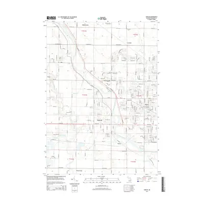
2014 Map of Shields
USGS Topo · Published 2014About this map
The Tittabawassee River flows through the heart of this Saginaw County landscape, defining the character of local settlements and land use in the early 2010s. The area around Shields and Shattuckville is notably dense with historical markers, particularly cemeteries that reflect the early community structure. Genealogy researchers will find significant value in the mapped locations of the Saginaw County Poor Farm Cem, McCarty Cem, and Owen Cem. These burial sites, along with others like Braley Cem and Bacon Cem, are scattered across the agrarian grid that transitions into the western suburbs of Saginaw. The map also captures the smaller crossroads of Lawndale and Paines, where local drainage systems like Huffman Drain and Dice Drain support the low-lying terrain. The road network, including the diagonal Midland Rd, highlights the longstanding connections between these riverbank communities.
Find a feature on this map
191 named features on this map. Tap any name to fly to it.
Don’t see what you’re looking for? This feature index may not catch every label — zoom into the map to look around manually.
Map Details
Editions of this 2014 Shields Map
This is the sole edition of this map. No revisions or reprints were ever made.
Other maps of this area

1916 · Bay City
USGS Topo · 1:62,500

1917 · St. Charles
USGS Topo · 1:62,500

1919 · Bay City
USGS Topo · 1:62,500

1919 · Saginaw
USGS Topo · 1:62,500

1941 · Saginaw
USGS Topo · 1:62,500

1943 · Bay City
USGS Topo · 1:62,500

1943 · Saginaw
USGS Topo · 1:62,500

1943 · St. Charles
USGS Topo · 1:62,500

1954 · Midland
USGS Topo · 1:250,000

1954 · Flint
USGS Topo · 1:250,000