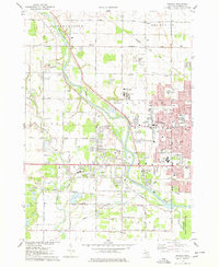
1975 Map of Shields
USGS Topo · Published 1978About this map
The Tittabawassee River and Swan Creek dictate the landscape of this Saginaw County region during the mid-1970s. This period shows significant suburban development and institutional growth west of the city, evidenced by the dense cluster of educational facilities including Eisenhower High Sch, MacArthur High Sch, and Swan Valley High Sch. The map records a diverse social geography, from the recreational Apple Mountain Ski Area and Saginaw Country Club to the specialized services of the Saginaw Community Hospital and the County Juvenile Center.
Find a feature on this map
78 named features on this map. Tap any name to fly to it.
Don’t see what you’re looking for? This feature index may not catch every label — zoom into the map to look around manually.
Map Details
Editions of this 1975 Shields Map
This is the sole edition of this map. No revisions or reprints were ever made.
Other maps of this area

1916 · Bay City
USGS Topo · 1:62,500

1917 · St. Charles
USGS Topo · 1:62,500

1919 · Bay City
USGS Topo · 1:62,500

1919 · Saginaw
USGS Topo · 1:62,500

1941 · Saginaw
USGS Topo · 1:62,500

1943 · Bay City
USGS Topo · 1:62,500

1943 · Saginaw
USGS Topo · 1:62,500

1943 · St. Charles
USGS Topo · 1:62,500

1954 · Midland
USGS Topo · 1:250,000

1954 · Flint
USGS Topo · 1:250,000