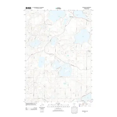
2013 Map of Shieldsville
USGS Topo · Published 2013About this map
Shieldsville sits at the heart of this lake-strewn landscape in Rice County, where the historic Dodd Rd intersects the shores of Shields Lake and Mud Lake. This area of Southern Minnesota is defined by its dense collection of glacial basins, including the larger waters of Mazaska Lake and Cedar Lake. The mapping reveals a transition between agricultural land and recreational lakefronts, highlighted by local landmarks like Fox Hill Farm near the Cannon River and Apple Creek Orchard to the east.
Find a feature on this map
66 named features on this map. Tap any name to fly to it.
Don’t see what you’re looking for? This feature index may not catch every label — zoom into the map to look around manually.
Map Details
Editions of this 2013 Shieldsville Map
This is the sole edition of this map. No revisions or reprints were ever made.
Other maps of this area

1953 · Saint Paul
USGS Topo · 1:250,000

1959 · Saint Paul
USGS Topo · 1:250,000

1960 · Faribault
USGS Topo · 1:24,000

1960 · Shieldsville
USGS Topo · 1:24,000

1960 · Lonsdale
USGS Topo · 1:24,000

1960 · Little Chicago
USGS Topo · 1:24,000

1962 · Morristown
USGS Topo · 1:24,000

1962 · Medford West
USGS Topo · 1:24,000

1966 · Montgomery
USGS Topo · 1:24,000

1966 · Waterville
USGS Topo · 1:24,000