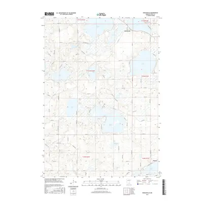
2016 Map of Shieldsville
USGS Topo · Published 2016About this map
Shieldsville and the surrounding Rice County lake country are defined by a dense network of glacial basins and interconnected waterways. The Cannon River winds through the center of the sheet, linking Hunt Lake and Wells Lake, while larger bodies like Shields Lake, Mazaska Lake, and French Lake dominate the northern half of the landscape. These water bodies, along with smaller features such as Weinberger Lake and Caron Lake, create a fragmented terrain where roads like Co Hwy 37 and Co Rd 71 must navigate narrow land bridges between the shorelines. At the southern edge, the settlement of Warsaw sits near the banks of Wells Lake, marking a localized center of activity. The abundance of named roads, including Camp Winona Trl and French Lake Trl, suggests a landscape heavily utilized for recreation and residential access to the waterfronts.
Find a feature on this map
75 named features on this map. Tap any name to fly to it.
Don’t see what you’re looking for? This feature index may not catch every label — zoom into the map to look around manually.
Map Details
Editions of this 2016 Shieldsville Map
This is the sole edition of this map. No revisions or reprints were ever made.
Other maps of this area

1953 · Saint Paul
USGS Topo · 1:250,000

1959 · Saint Paul
USGS Topo · 1:250,000

1960 · Faribault
USGS Topo · 1:24,000

1960 · Shieldsville
USGS Topo · 1:24,000

1960 · Lonsdale
USGS Topo · 1:24,000

1960 · Little Chicago
USGS Topo · 1:24,000

1962 · Morristown
USGS Topo · 1:24,000

1962 · Medford West
USGS Topo · 1:24,000

1966 · Montgomery
USGS Topo · 1:24,000

1966 · Waterville
USGS Topo · 1:24,000