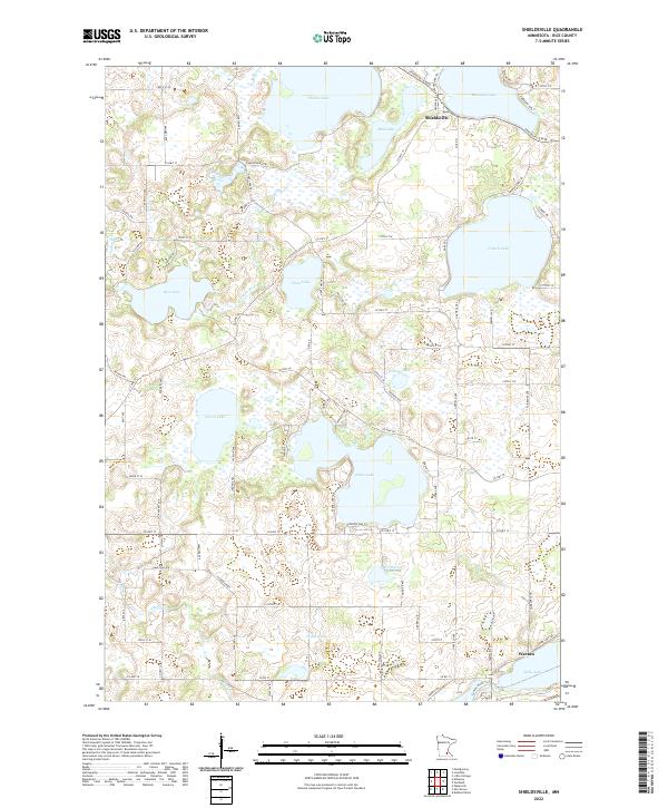
2022 Map of Shieldsville
USGS Topo · Published 2022About this map
Shieldsville stands as a central settlement in this lake-heavy landscape, situated near the shores of Shields Lake and Mazaska Lake. The region is defined by an intricate network of water bodies, including French Lake, Cedar Lake, and Hunt Lake, which are interconnected by various streams and the meandering path of the Cannon River. In the southern reaches, the village of Warsaw sits near the banks of Wells Lake, highlighting the historic reliance on these waterways for early commerce and transit.
Find a feature on this map
76 named features on this map. Tap any name to fly to it.
Don’t see what you’re looking for? This feature index may not catch every label — zoom into the map to look around manually.
Map Details
Editions of this 2022 Shieldsville Map
This is the sole edition of this map. No revisions or reprints were ever made.
Other maps of this area

1953 · Saint Paul
USGS Topo · 1:250,000

1959 · Saint Paul
USGS Topo · 1:250,000

1960 · Faribault
USGS Topo · 1:24,000

1960 · Shieldsville
USGS Topo · 1:24,000

1960 · Lonsdale
USGS Topo · 1:24,000

1960 · Little Chicago
USGS Topo · 1:24,000

1962 · Morristown
USGS Topo · 1:24,000

1962 · Medford West
USGS Topo · 1:24,000

1966 · Montgomery
USGS Topo · 1:24,000

1966 · Waterville
USGS Topo · 1:24,000