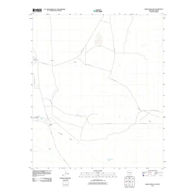
2010 Map of Shiloh Hills SE
USGS Topo · Published 2010About this map
The arid ranchlands of Otero County are defined by a network of ephemeral watercourses and isolated livestock stations. The landscape is carved by North Draw and the broad Cornudas Draw, which channel seasonal runoff through this high-desert region. Human activity is centered on established ranching operations like the McArron Ranch in the northwest and Bennett Ranch further south.
Find a feature on this map
16 named features on this map. Tap any name to fly to it.
Don’t see what you’re looking for? This feature index may not catch every label — zoom into the map to look around manually.
Map Details
Editions of this 2010 Shiloh Hills SE Map
This is the sole edition of this map. No revisions or reprints were ever made.
Other maps of this area

1951 · Dell City
USGS Topo · 1:62,500

1954 · Carlsbad
USGS Topo · 1:250,000

1954 · Van Horn
USGS Topo · 1:250,000

1955 · Cerro Diablo
USGS Topo · 1:62,500

1958 · Van Horn
USGS Topo · 1:250,000

1958 · Carlsbad
USGS Topo · 1:250,000

1969 · Lewis Canyon
USGS Topo · 1:24,000
1969 · Culp Draw
USGS Topo · 1:24,000
1970 · Shiloh Hills SE
USGS Topo · 1:24,000
1970 · Mc Veigh Hills
USGS Topo · 1:24,000