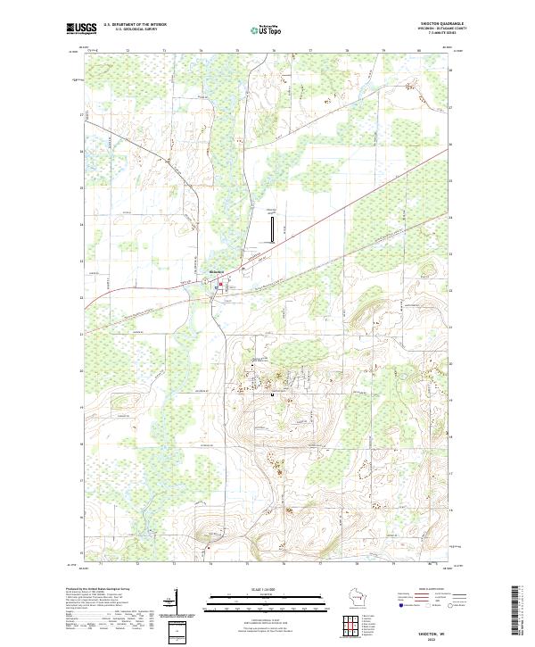
2022 Map of Shiocton
USGS Topo · Published 2022About this map
The Wolf River winds through the heart of this landscape, its expansive floodplains and surrounding wetlands defining the topography of Outagamie County. The village of Shiocton serves as the central hub, situated where the Wolf River and Shiocton River converge. This 2022 survey captures a rural environment where modern recreational infrastructure, like the Newton Blackmour State Trl, follows the path of former rail corridors, cutting a diagonal line across the township grid.
Find a feature on this map
57 named features on this map. Tap any name to fly to it.
Don’t see what you’re looking for? This feature index may not catch every label — zoom into the map to look around manually.
Map Details
Editions of this 2022 Shiocton Map
This is the sole edition of this map. No revisions or reprints were ever made.
Other maps of this area

1955 · Embarrass
USGS Topo · 1:48,000

1955 · Appleton
USGS Topo · 1:24,000

1955 · Appleton
USGS Topo · 1:62,500

1955 · Seymour
USGS Topo · 1:62,500

1955 · Green Bay
USGS Topo · 1:250,000

1956 · New London
USGS Topo · 1:48,000

1969 · New London
USGS Topo · 1:24,000
1969 · Hortonville
USGS Topo · 1:24,000

1969 · Leeman
USGS Topo · 1:24,000

1969 · Bear Creek
USGS Topo · 1:24,000