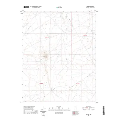
2023 Map of Ship Rock
USGS Topo · Published 2023About this map
The monolith of Ship Rock dominates this high-desert landscape in San Juan County, rising sharply from the surrounding plains. The topography is defined by intricate drainage networks, including the meandering paths of Shiprock Wash, Rattlesnake Wash, and Arroyo Del Pajarito. These ephemeral watercourses illustrate the desert's erosion patterns and natural irrigation routes that have historically dictated movement through the Navajo Nation. Modern transportation corridors like the Red Rock Hwy and various Bureau of Indian Affairs routes, such as Indian Svc Rte 571 and Indian Svc Rte 5010, cross the territory, connecting the high-altitude landmarks with local communities. The map provides a detailed look at the Public Land Survey System grid across T29N R19W and neighboring townships, offering a clear view of the land's administrative divisions and natural contours.
Find a feature on this map
11 named features on this map. Tap any name to fly to it.
Don’t see what you’re looking for? This feature index may not catch every label — zoom into the map to look around manually.
Map Details
Editions of this 2023 Ship Rock Map
This is the sole edition of this map. No revisions or reprints were ever made.
Other maps of this area

1889 · Chaco
USGS Topo · 1:250,000

1892 · Chaco
USGS Topo · 1:250,000

1927 · Sulphur Spring
USGS Topo · 1:96,000

1928 · Kirtland
USGS Topo · 1:125,000

1932 · Kirtland
USGS Topo · 1:125,000

1934 · Ship Rock
USGS Topo · 1:62,500

1934 · Chimney Rock
USGS Topo · 1:62,500

1934 · Rattlesnake
USGS Topo · 1:62,500

1936 · Chimney Rock
USGS Topo · 1:62,500

1937 · Ship Rock
USGS Topo · 1:62,500