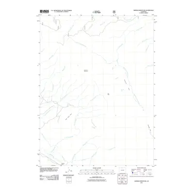
2011 Map of Shipman Mountain
USGS Topo · Published 2011About this map
Shipman Mountain dominates the center of this Larimer County landscape, where the high-altitude terrain is defined by a complex network of alpine drainage and early water management systems. The map illustrates the vital role of water diversion in this part of Colorado, showing the courses of the Ute Pass Ditch, Medicine Bow Ditch, and William Kerr Ditch. These man-made channels cut across the natural hydrology of East Sand Creek and McNally Creek, reflecting the historical engineering required to move water across the Continental Divide or between basins. Wide open meadows and parks, such as Shipman Park and Housmer Park, provide breaks in the topography near Ute Pass. Along the southern edge, the Canadian River flows near Williams Draw, while the northern reaches are fed by the many-forked headwaters of La Garde Creek and Grace Creek.
Find a feature on this map
29 named features on this map. Tap any name to fly to it.
Don’t see what you’re looking for? This feature index may not catch every label — zoom into the map to look around manually.
Map Details
Editions of this 2011 Shipman Mountain Map
This is the sole edition of this map. No revisions or reprints were ever made.
Other maps of this area

1916 · Home
USGS Topo · 1:125,000

1920 · Home
USGS Topo · 1:125,000

1950 · Kings Canyon
USGS Topo · 1:24,000

1952 · Kings Canyon
USGS Topo · 1:24,000

1954 · Greeley
USGS Topo · 1:250,000

1954 · Craig
USGS Topo · 1:250,000

1955 · Old Roach
USGS Topo · 1:24,000

1955 · Eagle Hill
USGS Topo · 1:24,000

1955 · Shipman Mountain
USGS Topo · 1:24,000

1955 · Gould NW
USGS Topo · 1:24,000