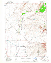
1948 Map of Shippee
USGS Topo · Published 1957About this map
Agricultural water management and a dense railroad network define this 1948 landscape in the Sacramento Valley. The map captures an era of intricate irrigation, shown through an extensive system of unnamed canals, a prominent Siphon, and Levee systems designed to manage the seasonal flows of Dry Creek and Cottonwood Creek. These engineering efforts supported the small settlements and junctions that dot the region, including the rail hubs of Ramada, Blavo, and Shippee.
Find a feature on this map
29 named features on this map. Tap any name to fly to it.
Don’t see what you’re looking for? This feature index may not catch every label — zoom into the map to look around manually.
Map Details
Editions of this 1948 Shippee Map
3 editions found
Other maps of this area

1888 · Marysville
USGS Topo · 1:125,000

1891 · Chico
USGS Topo · 1:125,000

1891 · Marysville
USGS Topo · 1:125,000

1893 · Chico
USGS Topo · 1:125,000

1894 · Marysville
USGS Topo · 1:125,000

1895 · Marysville
USGS Topo · 1:125,000

1895 · Chico
USGS Topo · 1:125,000

1911 · Landlow
USGS Topo · 1:31,680

1912 · Dry Creek
USGS Topo · 1:31,680

1912 · Durham
USGS Topo · 1:31,680