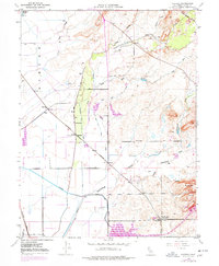
1948 Map of Shippee
USGS Topo · Published 1977About this map
Agricultural and transportation networks dominate this Butte County landscape, as documented through surveys in 1948 and photorevised in 1969. The territory is defined by an intricate system of water management, featuring a prominent Siphon, Levee, and multiple segments of Canal feeding through the plains toward the newly established Thermalito Afterbay. The intersection of industrial transit and local education is visible at the Floral Sch near Oroville Junc (Tres Vias), where the Western Pacific and Sacramento Northern railroads converge.
Find a feature on this map
31 named features on this map. Tap any name to fly to it.
Don’t see what you’re looking for? This feature index may not catch every label — zoom into the map to look around manually.
Map Details
Editions of this 1948 Shippee Map
3 editions found
Other maps of this area

1888 · Marysville
USGS Topo · 1:125,000

1891 · Chico
USGS Topo · 1:125,000

1891 · Marysville
USGS Topo · 1:125,000

1893 · Chico
USGS Topo · 1:125,000

1894 · Marysville
USGS Topo · 1:125,000

1895 · Marysville
USGS Topo · 1:125,000

1895 · Chico
USGS Topo · 1:125,000

1911 · Landlow
USGS Topo · 1:31,680

1912 · Dry Creek
USGS Topo · 1:31,680

1912 · Durham
USGS Topo · 1:31,680