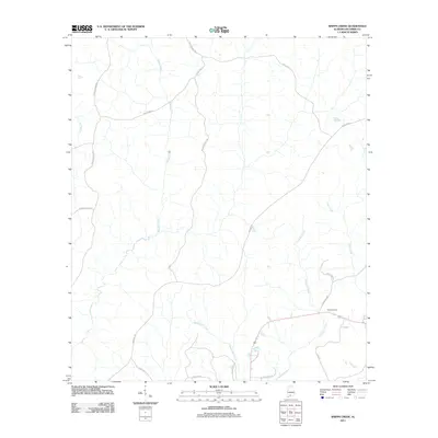
2011 Map of Shipps Creek
USGS Topo · Published 2011About this map
Shipps Creek and Bethea Mill Creek drain this landscape in Escambia County, characterized by a network of timber and access roads. The presence of Truck Trail 11 and the Miller Reserve Rd indicates an area managed for forestry or conservation. In the southeast, Still Cemetery serves as a significant point of local genealogy near the junction of Damascus Rd and Still Rd. The drainage patterns are well-defined by numerous waterways, including Crossway Creek, Clear Creek, and Long Branch, which reflect the region's low-lying riparian environment. Roadways like New Fishpond Rd, Murder Creek RD, and the curiously named Whynot Rd provide the primary transit through these rural woods and wetland margins.
Find a feature on this map
20 named features on this map. Tap any name to fly to it.
Don’t see what you’re looking for? This feature index may not catch every label — zoom into the map to look around manually.
Map Details
Editions of this 2011 Shipps Creek Map
This is the sole edition of this map. No revisions or reprints were ever made.
Other maps of this area

1953 · Andalusia
USGS Topo · 1:250,000

1957 · Andalusia
USGS Topo · 1:250,000

1959 · Brewton South
USGS Topo · 1:24,000

1960 · Brewton South
USGS Topo · 1:24,000

1960 · Brewton North
USGS Topo · 1:24,000

1971 · Castleberry
USGS Topo · 1:24,000

1982 · Shipps Creek
USGS Topo · 1:24,000
1982 · Roberts
USGS Topo · 1:24,000

1982 · Damascus
USGS Topo · 1:24,000

1982 · Nymph
USGS Topo · 1:24,000