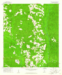
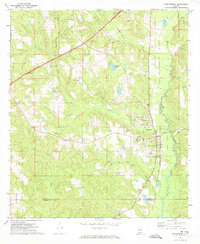
1960 Map of Brewton North
USGS Topo · Published 1961About this map
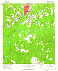
The city of Brewton serves as the focal point of this 1960 survey, situated where the Louisville and Nashville railroad corridor meets the winding waters of Murder Creek. The landscape transition from the established town center to the surrounding timberlands is marked by numerous institutional landmarks, including the Southern Normal Sch and Washington High Sch. These sites, along with the Country Club and nearby Anna Maria Lake, reflect the social and educational infrastructure of Escambia County during the mid-twentieth century.
Find a feature on this map
32 named features on this map. Tap any name to fly to it.
Don’t see what you’re looking for? This feature index may not catch every label — zoom into the map to look around manually.
Map Details
Editions of this 1960 Brewton North Map
3 editions found
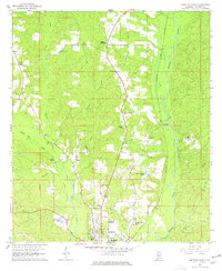
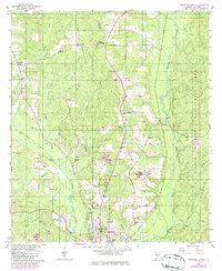
Other maps of this area

1953 · Andalusia
USGS Topo · 1:250,000

1957 · Andalusia
USGS Topo · 1:250,000
1959 · Brewton South
USGS Topo · 1:24,000
1960 · Brewton South
USGS Topo · 1:24,000
1960 · Pollard
USGS Topo · 1:24,000
1960 · Wallace
USGS Topo · 1:24,000
1971 · Range
USGS Topo · 1:24,000
1971 · Castleberry
USGS Topo · 1:24,000
1982 · Shipps Creek
USGS Topo · 1:24,000
1982 · Roberts
USGS Topo · 1:24,000