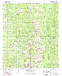
1960 Map of Brewton North
USGS Topo · Published 1986About this map
Brewton serves as the focal point of this 1960s-era landscape, where the confluence of Murder Creek and Burnt Corn Creek defines the local topography. The map illustrates a community shaped by education and faith, featuring the Southern Normal Sch and Washington High Sch alongside numerous rural congregations like Pilgrims Chapel and Zion Hill Ch. To the east, the Seaboard rail line runs parallel to the water, connecting the northern settlement of Kirkland to the regional hub.
Find a feature on this map
38 named features on this map. Tap any name to fly to it.
Don’t see what you’re looking for? This feature index may not catch every label — zoom into the map to look around manually.
Map Details
Editions of this 1960 Brewton North Map
3 editions found
Other maps of this area

1953 · Andalusia
USGS Topo · 1:250,000

1957 · Andalusia
USGS Topo · 1:250,000

1959 · Brewton South
USGS Topo · 1:24,000

1960 · Brewton South
USGS Topo · 1:24,000

1960 · Pollard
USGS Topo · 1:24,000

1960 · Brewton North
USGS Topo · 1:24,000

1960 · Wallace
USGS Topo · 1:24,000

1971 · Range
USGS Topo · 1:24,000

1971 · Castleberry
USGS Topo · 1:24,000

1982 · Shipps Creek
USGS Topo · 1:24,000