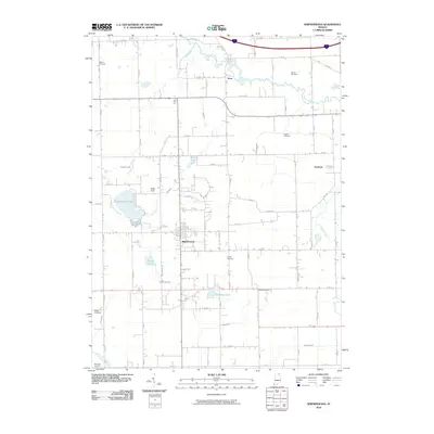
2010 Map of Shipshewana
USGS Topo · Published 2010About this map
Shipshewana serves as the central hub for this portion of LaGrange County, anchoring a landscape defined by its agricultural grid and an intricate network of drainage ditches and natural waterways. The town's proximity to Shipshewana Lake and the Pigeon River system influenced early settlement patterns and the development of local industry. This survey reveals a high concentration of community burial grounds, including the Bontrager Cemetery, Pashan Cemetery, and Miller Cemetery, which reflect the area's deep genealogical roots and early family-led settlements.
Find a feature on this map
66 named features on this map. Tap any name to fly to it.
Don’t see what you’re looking for? This feature index may not catch every label — zoom into the map to look around manually.
Map Details
Editions of this 2010 Shipshewana Map
This is the sole edition of this map. No revisions or reprints were ever made.
Other maps of this area

1914 · Three Rivers
USGS Topo · 1:62,500

1916 · Three Rivers
USGS Topo · 1:62,500

1943 · Three Rivers
USGS Topo · 1:62,500

1947 · Lagrange
USGS Topo · 1:24,000

1947 · Oliver Lake
USGS Topo · 1:24,000

1953 · Fort Wayne
USGS Topo · 1:250,000

1956 · Fort Wayne
USGS Topo · 1:250,000

1959 · Topeka
USGS Topo · 1:24,000
1959 · Oliver Lake
USGS Topo · 1:24,000

1959 · Millersburg
USGS Topo · 1:24,000