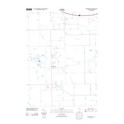
2013 Map of Shipshewana
USGS Topo · Published 2013About this map
Shipshewana serves as the central hub of this northern Indiana landscape, where a dense grid of local roads meets a complex network of agricultural drainage ditches and natural waterways. The town's layout, centered on streets like Davis St and E Middlebury St, is surrounded by a patchwork of small lakes and marshes, most notably Shipshewana Lake with its lakeside community at Beatys Beach. To the north and west, the Pigeon River meanders through the countryside near the small settlement of Scott.
Find a feature on this map
98 named features on this map. Tap any name to fly to it.
Don’t see what you’re looking for? This feature index may not catch every label — zoom into the map to look around manually.
Map Details
Editions of this 2013 Shipshewana Map
This is the sole edition of this map. No revisions or reprints were ever made.
Other maps of this area

1914 · Three Rivers
USGS Topo · 1:62,500

1916 · Three Rivers
USGS Topo · 1:62,500

1943 · Three Rivers
USGS Topo · 1:62,500

1947 · Lagrange
USGS Topo · 1:24,000

1947 · Oliver Lake
USGS Topo · 1:24,000

1953 · Fort Wayne
USGS Topo · 1:250,000

1956 · Fort Wayne
USGS Topo · 1:250,000

1959 · Topeka
USGS Topo · 1:24,000
1959 · Oliver Lake
USGS Topo · 1:24,000

1959 · Millersburg
USGS Topo · 1:24,000