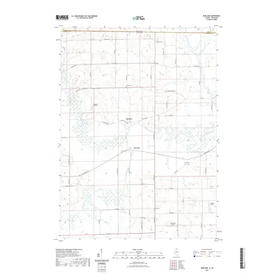
2021 Map of Shirland
USGS Topo · Published 2021About this map
The Pecatonica River and Sugar River converge in this northern Illinois landscape, defining the hydrological character of the area near the Wisconsin-Illinois border. The small settlements of Shirland and Harrison serve as the primary hubs of activity, surrounded by a grid of rural roads like Yale Bridge Rd and Freeport Rd. This survey documents a transition in land use, where traditional agricultural tracts are punctuated by the Sugar River Forest Preserve and several private airstrips, including Loeppert CPL Aero and Darrington Airport. For genealogists, the map provides precise locations for local burying grounds such as Shirland Cem, Harrison Cem, and the remote Phillips Cem. The terrain is shaped by numerous smaller waterways like Raccoon Cr and Timothy Cr, which meander through the low-lying basins of the larger river valleys.
Find a feature on this map
58 named features on this map. Tap any name to fly to it.
Don’t see what you’re looking for? This feature index may not catch every label — zoom into the map to look around manually.
Map Details
Editions of this 2021 Shirland Map
This is the sole edition of this map. No revisions or reprints were ever made.
Other maps of this area

1891 · Janesville
USGS Topo · 1:62,500

1893 · Janesville
USGS Topo · 1:62,500

1893 · Brodhead
USGS Topo · 1:62,500

1918 · Rockford
USGS Topo · 1:62,500

1932 · Pecatonica
USGS Topo · 1:62,500

1936 · Pecatonica
USGS Topo · 1:62,500

1938 · Rockford
USGS Topo · 1:62,500

1949 · Rockford
USGS Topo · 1:24,000

1954 · Rockford
USGS Topo · 1:250,000

1955 · Rockford
USGS Topo · 1:250,000