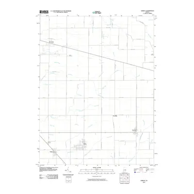
2010 Map of Shirley
USGS Topo · Published 2010About this map
Shirley and Wilkinson sit at a notable intersection of county lines and transportation corridors in this East Central Indiana landscape. The area's agricultural identity is clearly defined by an extensive network of drainage features such as Shirley Drain, Smith Ditch, and Nelson Ditch, which support the productivity of the surrounding fields. These man-made channels intermingle with natural waterways like Sugar Creek and Sixmile Creek, illustrating the long-term modification of the land for farming.
Find a feature on this map
78 named features on this map. Tap any name to fly to it.
Don’t see what you’re looking for? This feature index may not catch every label — zoom into the map to look around manually.
Map Details
Editions of this 2010 Shirley Map
This is the sole edition of this map. No revisions or reprints were ever made.
Other maps of this area

1949 · New Castle West
USGS Topo · 1:24,000

1950 · Dunreith
USGS Topo · 1:24,000

1952 · Anderson
USGS Topo · 1:24,000

1953 · Pendleton
USGS Topo · 1:24,000

1953 · Cincinnati
USGS Topo · 1:250,000

1953 · Muncie
USGS Topo · 1:250,000

1956 · Muncie
USGS Topo · 1:250,000

1956 · Cleveland
USGS Topo · 1:24,000

1957 · Cincinnati
USGS Topo · 1:250,000

1960 · New Castle West
USGS Topo · 1:24,000