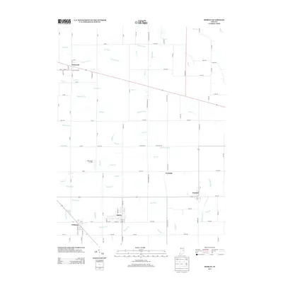
2013 Map of Shirley
USGS Topo · Published 2013About this map
Markleville and Shirley anchor this portion of East Central Indiana, where a highly organized grid of county roads defines the agricultural landscape. The region is characterized by an extensive network of managed waterways, including Chadwick Ditch, Farmer Ditch, and Collier Ditch, reflecting the historical importance of drainage for local farming. In the southern half of the map, the settlements of Wilkinson and Kennard sit near the winding course of Sixmile Cr, while the Sugar Creek Air Park offers a notable modern landmark. The agricultural character is further emphasized by seasonally named water features such as Oats Run, Grain Cr, Corn Run, and Maize Run, which highlight the primary crops that have long sustained these rural communities.
Find a feature on this map
111 named features on this map. Tap any name to fly to it.
Don’t see what you’re looking for? This feature index may not catch every label — zoom into the map to look around manually.
Map Details
Editions of this 2013 Shirley Map
This is the sole edition of this map. No revisions or reprints were ever made.
Other maps of this area

1949 · New Castle West
USGS Topo · 1:24,000

1950 · Dunreith
USGS Topo · 1:24,000

1952 · Anderson
USGS Topo · 1:24,000

1953 · Pendleton
USGS Topo · 1:24,000

1953 · Cincinnati
USGS Topo · 1:250,000

1953 · Muncie
USGS Topo · 1:250,000

1956 · Muncie
USGS Topo · 1:250,000

1956 · Cleveland
USGS Topo · 1:24,000

1957 · Cincinnati
USGS Topo · 1:250,000

1960 · New Castle West
USGS Topo · 1:24,000