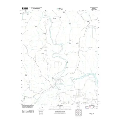
2011 Map of Shirley
USGS Topo · Published 2011About this map
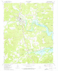
The Middle Fork Little Red River carves a winding path through this portion of Van Buren County, serving as the central geographic feature for several small communities. The town of Shirley sits along its banks, characterized by a concentrated grid of streets including 2nd D and 4th St. This area is rich with family-named topography and historic burial sites, reflecting a long-established rural settlement pattern. Significant genealogical markers are found at Settlement Cemetery, Collins Cemetery, and Rushing Cemetery, which serves the small northern hamlet of Rushing. The landscape is defined by prominent ridges and named peaks such as John Henry Mountain, Payne Mountain, and Lute Mountain. Numerous hollows like Bat Cave Hollow and Mule Hollow drain into a complex network of creeks, including Tick Creek and Greenbrier Creek, illustrating the intricate drainage system that has historically shaped local travel and agriculture.
Find a feature on this map
96 named features on this map. Tap any name to fly to it.
Don’t see what you’re looking for? This feature index may not catch every label — zoom into the map to look around manually.
Map Details
Editions of this 2011 Shirley Map
This is the sole edition of this map. No revisions or reprints were ever made.
Other maps of this area

1892 · Mountain View
USGS Topo · 1:125,000

1894 · Mountain View
USGS Topo · 1:125,000

1956 · Russellville
USGS Topo · 1:250,000

1964 · Russellville
USGS Topo · 1:250,000

1969 · Mountain View SW
USGS Topo · 1:24,000
1969 · Fox
USGS Topo · 1:24,000
1973 · Fairfield Bay
USGS Topo · 1:24,000
1973 · Greers Ferry
USGS Topo · 1:24,000
1973 · Clinton
USGS Topo · 1:24,000
1973 · Oxley
USGS Topo · 1:24,000